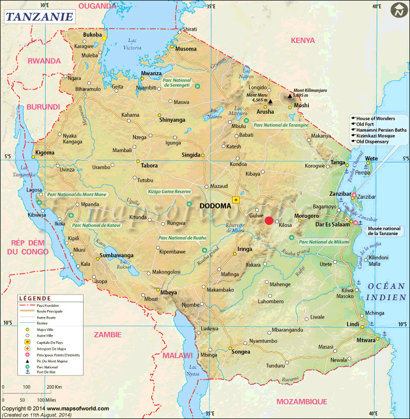
Here are some maps of the area.
To the right of the red dot representing Chabima, towards the east, you can see the cities of Morogoro, capital of the eponymous region, and Kilosa, one of the districts. We see that Kilosa is in the plain, at 500 meters of altitude, while Chabima is full west in the mountain. These are the mountains Usagara.
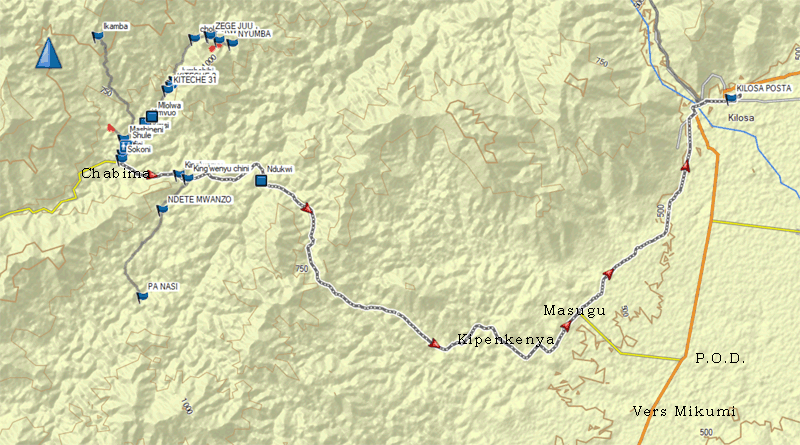
To the right is Kilosa, bordered by the river Mkondoa (called Wami on Gogol Earth). So you can walk along the mountain to Masugu, then start climbing towards Kipekenya and Chabima. You can also go down the road that goes to Mikumi and turn right, full west, at the place called P.O.D. (we pronounce [pi-o-di]).
From Kipekenya to Chabima it is the full forest, now a little cleared along the road by the cutting of trees in order to let pass the power line (which is not yet in tension, and should provide electricity to Chabima and Kipekenya).

This map taken from Gogol Earth shows the route from the crossroads with the road, called kibaoni be "to the board", until my home in the valley of Chole. The top of the map is not yet clearly photographed, the limit on the route corresponds to the pass bordering the Chole valley.
At the bottom of the map is the road that leads to Kipekenya, and therefore to Kilosa.
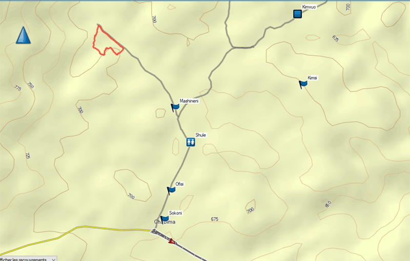
From the crossroads, Kibaoni, we pass the market, sokoni, then the village office, or town hall, called ofisi on the map. We go along the soccer field on the left and we get to the school, shule. Mashineni means the grain mill. From there one can either go towards the river and cross it, or go towards the district of Shuleni juu, which means At the top of the school. In this valley there is a field belonging to Kimsi, with an area of two and a half acres (one hectare), where mango trees and some other fruit trees have been planted. They were victims of the drought, in part because we planted them last March and didnt water them. Between the plants Kimsi had planted maize, as other reports have mentioned, and now that the maize has been harvested he plans to plant beans. The red dot visible on the map below corresponds to a small area where we considered digging a well.
It is therefore better to plant in November or early December, the trees do not have time to sink deep roots into the ground when they are planted in March or April. This explains why, despite the promise of orders these days, farmers are reluctant to fulfill their orders.
On the map you can follow the path from mashineni, the mill, to the river.

The map shows the three rivers, marked with a blue square :
![]() The Chabima River, below Mashineni.
It is indicated on the map by Mto wa Chabima. The bridge
consists of simple planks.
The Chabima River, below Mashineni.
It is indicated on the map by Mto wa Chabima. The bridge
consists of simple planks.
![]() The Kimvuo River, intermittent, where
we built a hard bridge.
The Kimvuo River, intermittent, where
we built a hard bridge.
![]() The perennial Mlolwa River, which was
crossed with a drift, and where we built a two-arched bridge when the
drift was washed away last year. Access was cleaned last week.
The perennial Mlolwa River, which was
crossed with a drift, and where we built a two-arched bridge when the
drift was washed away last year. Access was cleaned last week.
On the left you can see the path that goes up to Ikamba. On the right the path that leads to Kimsi's, at the top of a small hill.
From Mlolwa, the path leads to the red climb, kitelemko chekundu, abbreviated in kiteche on the map. This climb, with a coefficient of around 20%, is made up of red clay, which is particularly slippery during the rainy season. At the top begins the valley of Jumbebibi, which leads to thae one of Chole.
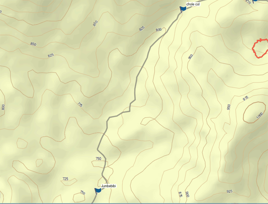
Jumbebibi Valley. The path runs along the Mlolwa River, which rises on Mount Ikamba. The road is sometimes clayey and needs to be repaired at least once a year after heavy rains.
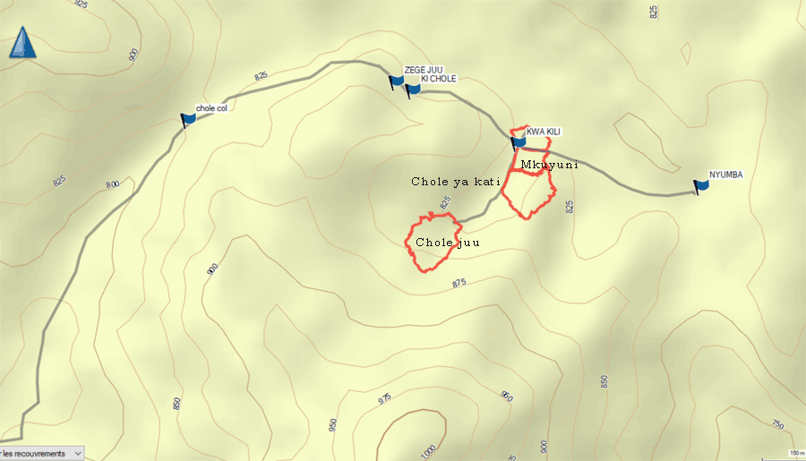
The valley of Chole, from the pass. We go along the valley, slightly in height as shown by the contour on the map. We go down a steep descent that is also close to 20%, made of so slippery red clay that we had to have it cemented. This passage is called zege, which means cement.
There are few names of places, a place or another being designated by the field cultivated by one of the villagers: Kwa Kili, or at Christophe's, his name pronounced Kilistofa in Swahili (Christopher). We decided to give names to be more specific, the term Chole being too vague. The small valley was therefore named Chole ya kati, or Chole centre. The fields in red, which belong to Kimsi, have received the name of Mkuyuni, Mkuyu being a tree providing kinds of wild, edible figs.
Mkuyu refers to all kinds of ficus, except for the Mediterranean fig tree, Ficus carica, or mtini in Swahili.
At the top of the valley we gave the name of Chole juu, or Chole the top. It is where the trials have now been transplanted, about ten minutes walk from the house, Nyumba.
The field next to the "Kwa Kili" point has been bordered by the river since last year, when floods made it take a new course.